
Update: on 1 March Isil was reported to be pulling out of Palmyra after Russian-backed Syrian troops began regaining lost ground. Before experts can assess the latest damage on the ground, mines will need to be cleared from the site.
A super-small satellite, or “cubesat”, dedicated to cultural heritage could help a Boston-based non-profit organisation to monitor destruction by extremists in Syria, a Getty Research Institute panel on protecting the region’s cultural heritage heard in February.
The archaeologist Scott Branting of the University of Central Florida (UCF), who helps to direct the American Schools of Oriental Research’s Cultural Heritage Initiatives (ASOR CHI), said: “We need to start thinking about the potential of putting up cultural heritage satellites of our own.” With propulsion, a miniature satellite the size of a milk carton and weighing no more than 1.3kg could fly over and take images of Palmyra “when we suspect something is going on, or perhaps park in geostationary orbit over particularly important sites that have seen looting in the past”, Branting said.
Although this may seem like wishful thinking to some, Branting has a plan. Colleagues at UCF, which manages the Florida Space Institute, are planning to launch more cubesats this year, and ASOR CHI is looking to work with the university. “The cubesat idea is something that we are beginning to develop. UCF’s proximity to the Kennedy Space Center and existing involvement with Nasa there, as well as cubesat projects that UCF is currently undertaking, would lower the costs,” he tells The Art Newspaper.
Although he is hopeful that the idea will attract potential funders, Branting says that the project depends on continued support for ASOR’s initiative from a key funder: the US State Department. Since 2014, the project has received around $1m a year in federal funding. As we went to press, ASOR was waiting to hear whether that would continue under President Donald Trump.
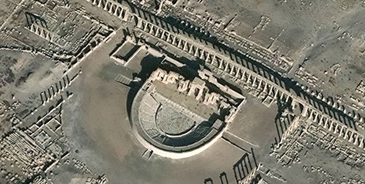
When ASOR CHI started three years ago, archaeologists studying Syria suffered from a lack of satellite imagery. Unless they got a grant from a commercial imaging company like DigitalGlobe, “we very often had one or two images”, Branting said. Now, “we can literally have tens of thousands or hundreds of thousands of images stretching back across the conflict, and in some cases, [images taken as recently as] around 24 hours ago. From that, we can see a wide swathe of what’s happening across immense areas—all of Syria can be imaged and viewed.”
But there are challenges in obtaining satellite imagery with the frequency and specificity desired, he said, noting that ASOR CHI is not always high in the “pecking order of agencies in terms of who can task the satellites to take particular images” or secure their release.
Branting showed the Getty panel before-and-after images of the Temple of Baalshamin and the Temple of Bel in Palmyra, documenting their destruction by Isil in 2015. The idea is that this information could help “cultural heritage first-responders” in restoration efforts.